Savannah's Best Illustrated Map!
Double-sided in vivid detail!
8th Edition updated for 2026


With walking shoes on and this birds-eye-view guide map in hand, you'll feel like you stepped back in time in Savannah's Historic Landmark District. Beautiful, functional, and informative, this is the only Savannah map you'll need in a city where a historic building, monument or point of interest beckons around every corner.
History lovers will marvel at the many factoids explaining Savannah's rich, colorful, and sometimes dark history. The map features pictorial depictions of popular landmarks so you know what to expect and how to get there. Included are Savannah's "dot" free shuttle and ferry stops to get you around town quicker.
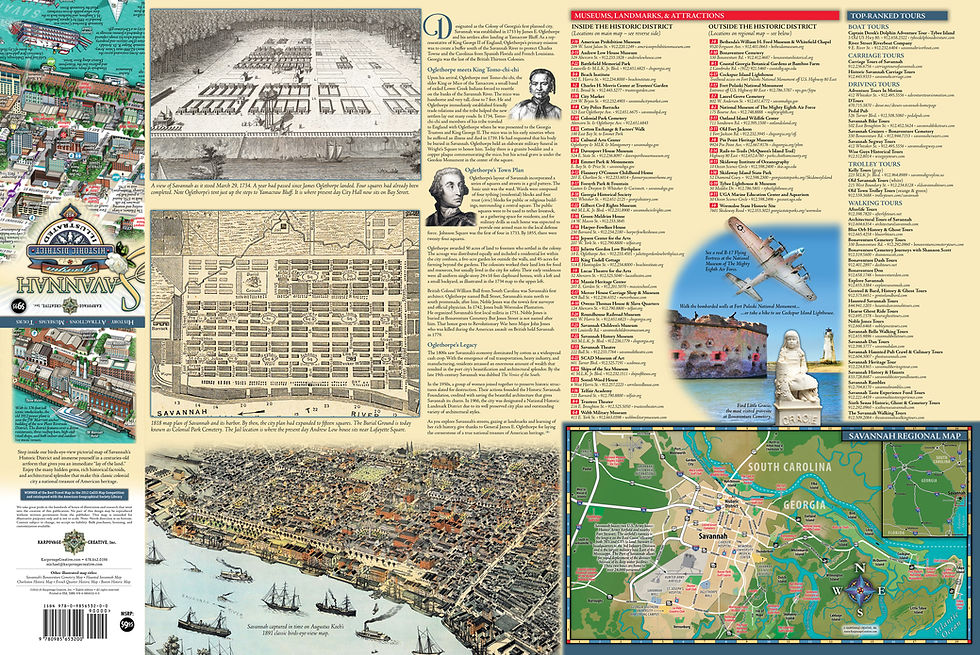
Our national award-winning map of Savannah comes folded at a convenient 4×9" size to stow in a pocket or purse and unfolds to 18×27" to reveal the captivating artwork within. You'll see a “lay of the land” mirroring the classic maps of Savannah in the 19th century that traditionally depict the river on bottom (or North) to show off the old port and River Street. The map isn't upside-down. Just ground your orientation and navigate by landmarks.

On the reverse side, you'll read of the famous squares of Savannah and how they originated. Attractions are listed with their contact information and grid location so you know where to find them on the map. We also give you top-ranked, professional tour guide listings should a narrated tour be up your alley. Plus, we have a regional Savannah map showing the best attractions should you wish to venture outside Savannah's historic district.
Don't navigate from a tiny phone screen, as you miss the history that surrounds you. And don't settle for the small, flimsy throwaway freebie maps devoid of any history, filled with distracting ads. Our Savannah city map is advertisement-free, of high quality durable paper (not laminated), and meant as a true souvenir walking tour guide.
Get Our Map Or Get Lost!
"This Savannah Historic District Illustrated Map is flat out impressive on many levels. For pure utility it clearly and concisely provides the information needed to navigate, but it goes so far beyond that. The attention to detail is intriguing and entertaining at the same time, compelling the user to immerse themselves in the artwork as they explore every aspect of the map."
– Mike Westby, reviewer

